iOS · Android · 7 languages
Risk-free on the way home. Now on your phone.
The ICE-Tracker map, the risk-scored route planner and the read-aloud feed, built for the road. Anonymous: no sign-up, no login.
Three tabs, one job: get home safely
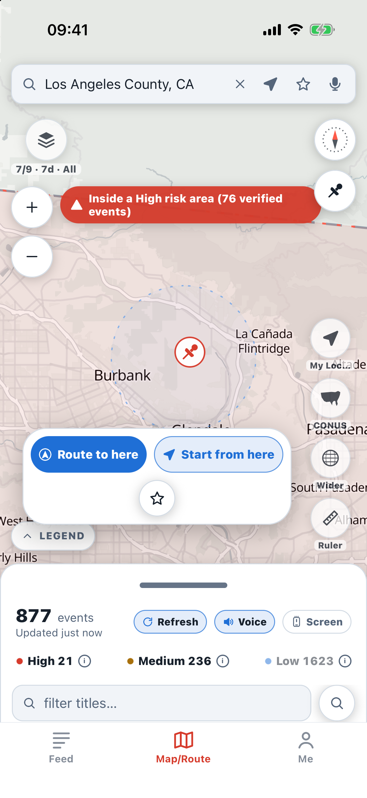
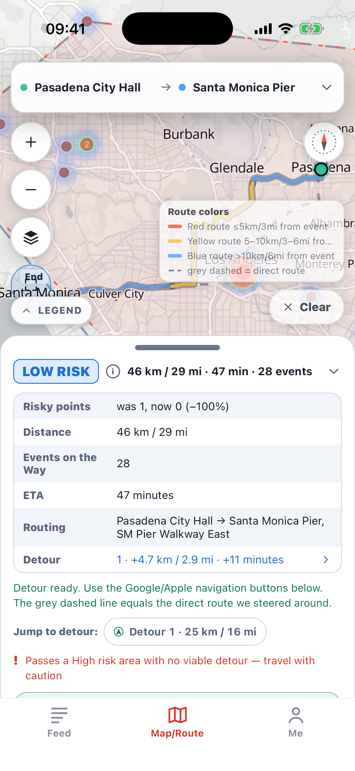
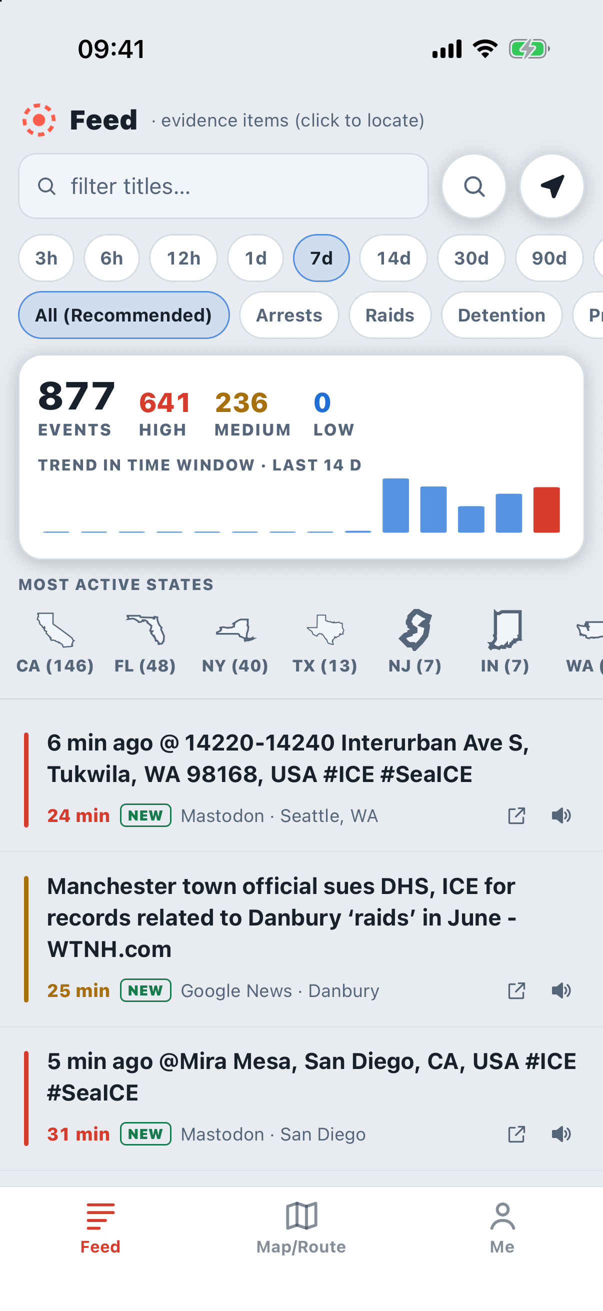
Swipe through a real trip
Screens recorded on a real device with live data; auto-plays every 5 s, swipe or use the arrows.
From “where am I” to turn-by-turn, in one minute
- Locate meThe Map tab finds you; the chip “Route from my location” appears under the dot.
- Start = my locationOne tap opens the Route tab with the start filled in as “My Location (lat, lng)”.
- Pick the destinationType a city, town, ZIP or place; suggestions show state and straight-line distance. Both ends are framed on the map.
- AnalyzeThe planner scores the trip and detours around risk areas; the whole route is framed with its colours.
- Avoid risk areasThe route bends around the reported risk area; tap “Detour” in the result to jump to that stretch.
- Turn-by-turnNavigate or Simulation: voice and banner directions on our own route, with an alert when a risk area is ahead.
Plan, check, go
Set start and destination
Type a city, ZIP or address, use your location, tap two points on the map, or paste a Google / Apple Maps link.
Read the risk along the way
The route is coloured by distance to events. Risky points get a 5 km / 3 mi radius; the planner detours around them when it saves more than it costs.
Hand off and drive
Open the trip in Google or Apple Maps with the detour stops pinned, or replay it first with Simu-Drive.
What else is in the app
7 languages
English, 中文, Español, Français, ไทย, 한국어, 日本語, with news read aloud in your language.
Same data as the site
Public reports, news in nine languages, official releases and community posts, refreshed every few minutes.
Anonymous by design
No account, no login. Nothing you type is tied to you; usage data only improves the app.
Works offline
The last data set stays on the phone, and the app tells you plainly when the server cannot be reached.
Apple CarPlay
Plug in and the same map, risk areas and turn-by-turn guidance appear on the car's screen, with voice alerts when a risk area is ahead.
Fully anonymous
No sign-up, no login. The information the app collects is used only to improve the experience.
On solid legal ground
Public-source aggregation protected by the First Amendment and settled case law; no personal information about officers is ever published. Read the full statement
*“Risk-free” and “zero risk” describe what the app aims for, not a promise: all data is automatically aggregated from public sources and can be late, incomplete or wrong. Risk levels and detours are estimates for your own judgement; they are not safety or legal advice, and you remain responsible for how you travel.